TREES Research Lab
  • Home
  • Team
    • Leaders
    • Postdocs
    • PhD Students
    • Master Students
    • Undergraduate students
    • Research Assintents
    • Collaborators
    • Alumini
  • Publications List
    • Peer-reviewed scientific articles
    • Conference proceedings
    • Technical Report
    • Book Chapter
    • Yearbook Edition
  • Projects
    • MAPFIRE
      • The team
      • Publications List
      • Dataset
    • Boca do Acre
      • The team
      • Publications List
      • Dataset
      • Technical Reports
      • Media
    • MAPFIRE - MA
      • The team
      • Publications List
      • Dataset
    • VOZES
      • The team
      • Publications List
      • Dataset
    • Postdoc projects
      • FAPESP 18/14423-4
      • FAPESP 19/25701-8
      • FAPESP 22/04893-9
Search

Free Training Opportunity with NASA Applied Remote Sensing Education and Training project 

9/20/2013

0 Comments

 
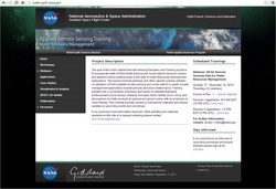
 Imagem
Free Training Opportunity

Course: NASA Remote Sensing Data for Water Resources Management

October 17 - November 14, 2013, Thursdays (5 webinars) 


Course Agenda

Session I registration: 8-9 AM EDT (12 PM UTC)  click here 

Session II registration: 1-2 PM EDT (5 PM UTC),  click here 

For further Information contact: amita.v.mehta@nasa.gov

According to NASA website
http://water.gsfc.nasa.gov/

they aim to increase the utility of NASA Earth Science and model data for decision-makers and applied science professionals in the area of Water Resources Management Applications.  NASA is running several capacity building activities on utilization of NASA satellite remote sensing and model data for a variety of water management applications including floods and snow related topics. 

If you would like more information about any of the activities and materials available on the program or to request a training please contact:Ana.I.Prados@nasa.gov


0 Comments


Leave a Reply.

    Author

    Luiz Aragão

    Archives

    July 2019
    July 2018
    November 2014
    October 2014
    May 2014
    October 2013
    September 2013

    Categories

    All

    RSS Feed

Powered by Create your own unique website with customizable templates.
  • Home
  • Team
    • Leaders
    • Postdocs
    • PhD Students
    • Master Students
    • Undergraduate students
    • Research Assintents
    • Collaborators
    • Alumini
  • Publications List
    • Peer-reviewed scientific articles
    • Conference proceedings
    • Technical Report
    • Book Chapter
    • Yearbook Edition
  • Projects
    • MAPFIRE
      • The team
      • Publications List
      • Dataset
    • Boca do Acre
      • The team
      • Publications List
      • Dataset
      • Technical Reports
      • Media
    • MAPFIRE - MA
      • The team
      • Publications List
      • Dataset
    • VOZES
      • The team
      • Publications List
      • Dataset
    • Postdoc projects
      • FAPESP 18/14423-4
      • FAPESP 19/25701-8
      • FAPESP 22/04893-9